Geographic maps people have been using since ancient times. The first attempts to depict the surface of the Earth were made in ancient Greece by such scientists as Eratosthenes and Hipparchus. Naturally, cartography as a science has advanced far since then. Modern maps are created using satellite imagery and computer technology, which, of course, helps to increase their accuracy. And yet, on every geographical map there are some distortions regarding natural shapes, angles or distances on the earth's surface. The nature of these distortions, and, consequently, the accuracy of the map, depends on the types of cartographic projections used to create a particular map.
The concept of map projection
Let's take a closer look at what a map projection is and what types of them are used in modern cartography.
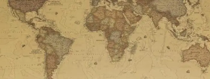
Map projection is an image of the Earth's surface on a plane. Morea scientifically deep definition sounds like this: a cartographic projection is a way of displaying points on the Earth's surface on a certain plane, in which some analytical dependence is established between the coordinates of the corresponding points of the displayed and displayed surfaces.
How is a map projection built?
Construction of any kind of map projections takes place in two stages.
- Firstly, the geometrically irregular surface of the Earth is mapped onto some mathematically correct surface, which is called the reference surface. For the most accurate approximation, the geoid is most often used in this capacity - a geometric body bounded by the water surface of all seas and oceans, interconnected (sea level) and having a single water mass. At every point on the surface of the geoid, gravity is applied normally. However, the geoid, like the physical surface of the planet, also cannot be expressed by a single mathematical law. Therefore, instead of the geoid, an ellipsoid of revolution is taken as the reference surface, giving it the maximum similarity to the geoid using the degree of compression and orientation in the Earth's body. They call this body an earth ellipsoid or a reference ellipsoid, and in different countries they take different parameters.
- Secondly, the accepted reference surface (reference ellipsoid) is transferred to the plane using one or another analytical dependence. As a result, we get a flat cartographic projection of the earth's surface.
Projection distortion
Don't youwondered why the outlines of the continents differ slightly on different maps? On some map projections, some parts of the world appear larger or smaller relative to some landmarks than on others. It's all about the distortion with which the projections of the Earth are transferred to a flat surface.
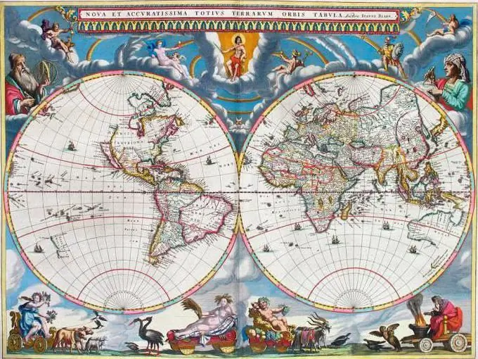
But why do map projections display in a distorted way? The answer is pretty simple. A spherical surface is not possible to deploy on a plane, avoiding folds or breaks. Therefore, the image from it cannot be displayed without distortion.
Methods for obtaining projections
Studying map projections, their types and properties, it is necessary to mention the methods of their construction. So, map projections are obtained using two main methods:
- geometric;
- analytical.
The geometric method is based on the laws of linear perspective. Our planet is conditionally taken as a sphere of some radius and projected onto a cylindrical or conical surface, which can either touch or cut through it.
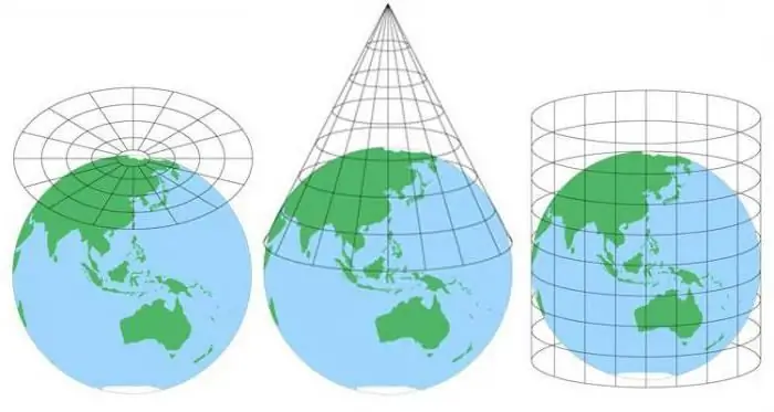
Projections obtained in this way are called perspective. Depending on the position of the observation point relative to the Earth's surface, perspective projections are divided into types:
- gnomonic or central (when the point of view is aligned with the center of the earth's sphere);
- stereographic (in this case, the observation point is located onreference surfaces);
- orthographic (when the surface is observed from any point outside the sphere of the Earth; the projection is built by transferring the points of the sphere using parallel lines perpendicular to the display surface).
The analytical method for constructing map projections is based on mathematical expressions connecting points on the sphere of reference and the display plane. This method is more versatile and flexible, allowing you to create arbitrary projections according to a predetermined nature of the distortion.
Types of map projections in geography
To create geographic maps, many types of projections of the Earth are used. They are classified according to various criteria. In Russia, the Kavraysky classification is used, which uses four criteria that determine the main types of cartographic projections. The following are used as characteristic classifying parameters:
- character distortion;
- form of displaying the coordinate lines of the normal grid;
- location of the pole point in the normal coordinate system;
- how to use.
So, what are the types of map projections according to this classification?
Projection classification
The following is a classification of types of map projections with examples, based on the above main criteria.
By the nature of the distortion
As mentioned above, distortion is, in fact, an inherent property of any projection of the Earth. Any characteristic can be distortedsurfaces: length, area or angle. According to the type of distortion, they distinguish:
- Conformal or conformal projections, in which azimuths and angles are transferred without distortion. The coordinate grid in conformal projections is orthogonal. Maps obtained in this way are recommended to be used to determine distances in any direction.
- Equivalent or equivalent projections, where the scale of areas is preserved, which is taken equal to one, i.e. areas are displayed without distortion. Such maps are used to compare areas.
- Equidistant or equidistant projections, in the construction of which the scale is preserved in one of the main directions, which is taken as a single one.
- Arbitrary projections, on which all kinds of distortions can be present.
According to the form of displaying the coordinate lines of the normal grid
This classification is the most visual and, therefore, the easiest to understand. Note, however, that this criterion applies only to projections oriented normally to the observation point. So, based on this characteristic feature, the following types of cartographic projections are distinguished:
Circular, where the parallels and meridians are circles, and the equator and the average meridian of the grid are straight lines. Such projections are used to depict the surface of the Earth as a whole. Examples of circular projections are the conformal Lagrange projection, as well as the arbitrary Grinten projection.
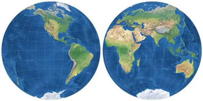
Azimuth. In this case, the parallels representin the form of concentric circles, and the meridians in the form of a bundle of straight lines diverging radially from the center. A similar kind of projection is used in a direct position to display the poles of the Earth with adjacent territories, and in a transverse position as a map of the western and eastern hemispheres familiar to everyone from geography lessons.
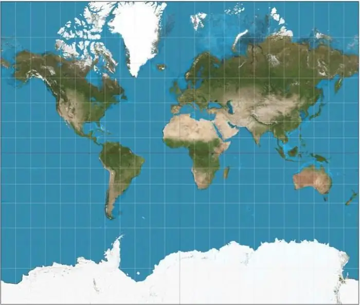
Cylindrical, where meridians and parallels are represented by straight lines intersecting normally. Territories adjacent to the equator or stretched along some standard latitude are displayed here with minimal distortion.
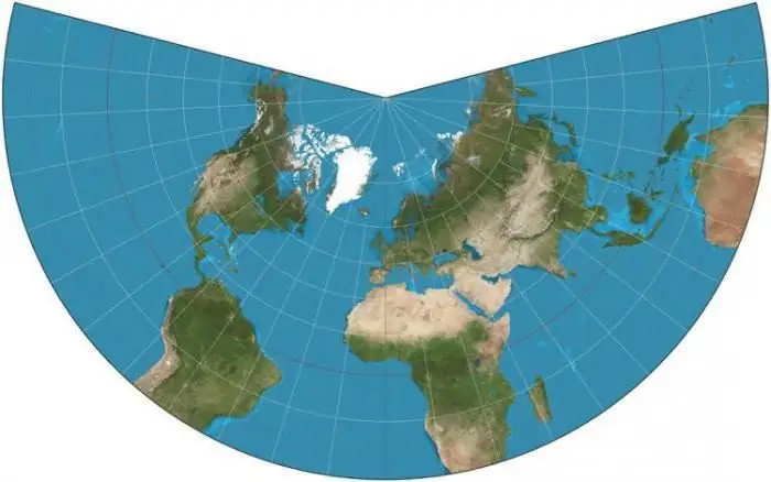
Conic, representing a development of the lateral surface of the cone, where the lines of parallels are arcs of circles centered at the top of the cone, and the meridians are guides diverging from the top of the cone. Such projections most accurately depict territories lying in middle latitudes.
Pseudoconic projections are similar to conic projections, only the meridians in this case are depicted as curved lines symmetrical with respect to the rectilinear axial meridian of the grid.
Pseudo-cylindrical projections resemble cylindrical ones, only, as well as in pseudo-conical ones, the meridians are depicted by curved lines symmetrical to the axial rectilinear meridian. Used to depict the entire Earth (e.g. Mollweide elliptical, equal area sinusoidalSanson, etc.).
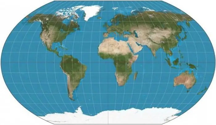
Polyconic, where parallels are depicted as circles, the centers of which are located on the middle meridian of the grid or its continuation, the meridians are in the form of curves located symmetrically to the rectilinear axial meridian.
By the position of the pole point in the normal coordinate system
- Polar or normal - the pole of the coordinate system is the same as the geographic pole.
- Transverse or transverse - the pole of the normal system is aligned with the equator.
- Slanted or oblique - the pole of the normal grid of coordinates can be located at any point between the equator and the geographic pole.
According to the method of application
The following types of map projections are distinguished by the method of use:
- Solid - the projection of the entire territory onto a plane is carried out according to a single law.
- Multi-lane - the mapped area is conditionally divided into several latitudinal zones, which are projected onto the display plane according to a single law, but with a change in the parameters for each zone. An example of such a projection is the trapezoidal Muefling projection, which was used in the USSR for large-scale maps until 1928.
- Multifaceted - the territory is conditionally divided into a number of zones in longitude, projection onto a plane is carried out according to a single law, but with different parameters for each of the zones (for example, the Gauss-Kruger projection).
- Composite, when some part of the territorymapped onto a plane using one pattern, and the rest of the territory on the other.
The advantage of both multi-lane and multi-faceted projections is the high accuracy of display within each zone. However, a significant disadvantage is the impossibility of obtaining a continuous image.
Of course, every map projection can be classified using each of the above criteria. So, the famous projection of the Earth Mercator is conformal (equiangular) and transverse (transversion); Gauss-Kruger projection - conformal transverse cylindrical, etc.


